|
|
|
|
|
|
|
Achi-Kochi Japan
Showing many places to visit and foods to eat in Japan
|
|
|
|
|
|
|
|
|
|
|
|
|
Japan
> Hokuriku region
> Tateyama
|
|
|
|
|
|
|
Tateyama
Toyama Pref., Hokuriku ( Achi-Kochi Japan )
|
|
|
|
|
|
|
|
|
|
|
|
|
( "Achi-Kochi" in Japanese means "Here and there" in English. )
Tateyama, Toyama Pref., Hokuriku region
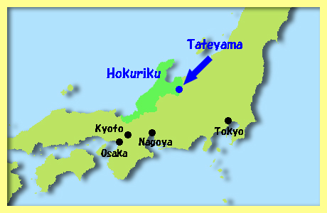
Tateyama Mountain Range ( above ) is located in the southeast of Toyama Prefecture and in the east of Hokuriku Region. The Tateyama Kurobe Alpine Route enables tourists to visit Tateyama. The entire Route is open from late April to November while a heavy snowfall makes the route closed in winter.
Tateyama Kurobe Alpine Route connects Toyama City in Toyama Prefefcture and Omachi Town in Nagano Prefecture with cablecars, a ropeway, trains and buses. Some sections of the Route, including access to Murodo-daira, are not open to private vehicles.
|
|
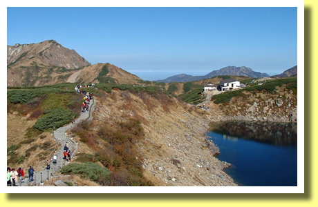
Murodo-daira
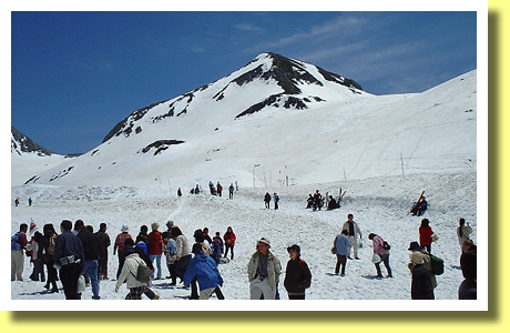
Heavy snowfall makes Tateyama Kurobe Alpine Route closed through winter. Once the Route is opened in late April or early May, the Route transport lots of tourists to the sites such as Murodo-daira ( or Murodo - above ), which is the most popular site along the Route.
Murodo-daira, located at 2,450 meters above sea, offers a view of some mountains higher than 3,000 meters. Also there in Murodo-daira are some accommodation facilities, onsen ( hot springs ), lakes, valleys, walking paths, shops, a bus station and so on.
|
|
Yuki-no-Otani ( snow walls )
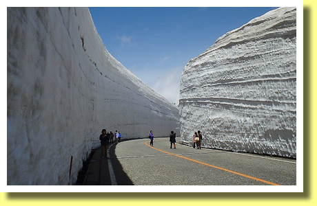
Tourists, who visit Murodo-daira in late April - early May, could see the most popular attraction called " Yuki-no-Otani " ( snow walls or snow corridor - above ), which shows how heavy the snowfall is in the area. The height of snow walls could be as high as 20 meters. Snow walls could disappear in June.
|
|
Mountains
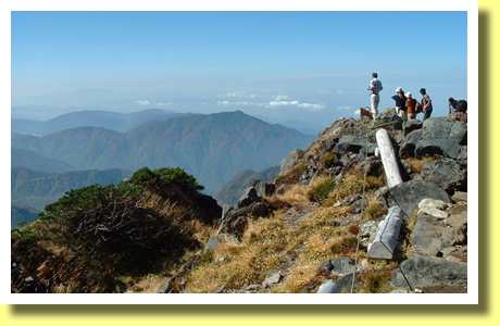
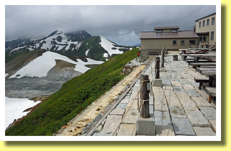
From Murodo-daira, tourists could climb up to the tops of mountains, some of which are higher than 3,000 meters. The tops would offer a fantastic view of Japanese Alps ( above ).
However the mountain paths are steep and rocky. In addition, even in July, mountain paths could be frozen sometimes. So tourists, climbing up to the summits, are expected to be experienced and well organised.
|
|
Walking Paths
Even without climbing up to the tops of mountains, walking paths around Murodo-daira would help tourists enjoy viewing various landscapes of mountains and lakes such as Mikuri-ga-ike Pond ( above ), which is a volcanic lake and is located at 2,405 meters above sea.
|
|
Onsen ( hot spring )
There is Mikuri-ga-ike Onsen ( hot spring - above ) near Mikuri-ga-ike. It is said that Mikuri-ga-ike Onsen is the highest elevation hot spring in Japan. Tourists could enjoy a mountain view in a onsen bath, whose hot water comes directly from Jigoku-dani ( hell valley ) located beneath the Onsen.
|
|
Jigoku-dani ( hell valley )
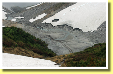
There beneath Mikuri-ga-ike Onsen is Jigoku-dani ( hell valley ), in which there is the source of Onsen hot water. However it is prohibited to walk around Jigoku-dani due to poisonous volcanic gas.
|
|
Raicho ( Rock Ptarmigan )
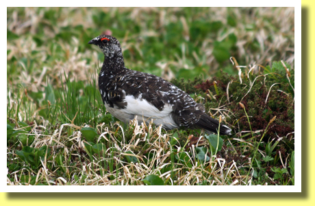
While walking around Murodo-daira, tourists could see Raicho ( Rock Ptarmigan - above ), which live at altitudes higher than 2,200 meters and which is designated one of National Special Natural Monuments of Japan.
Their feathers moult from dark in summer to white in winter. However it is not easy to see their white feathers because Tateyama Kurobe Alpine Route is closed through winter. They are now in danger of extinction due to foxes, monkeys, crows and so on. It is said that about 2,000 Raicho are surviving in Japan.
|
|
Alpine Plants
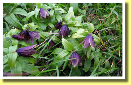
In June-August, tourists walking around Murodo-daira, could see flowers of alpine plants such as Rice Lily ( above ). Unfortunately flowers of Rice Lily have bad smell. So they are also called " outhouse lily ", " skunk lily " or " dirty diaper ". Floweres of deer cabbage, arctic starflower and narcissus-flowered anemone could be seen around Murodo-daira as well.
|
|
Oyama Jinja ( shrine )
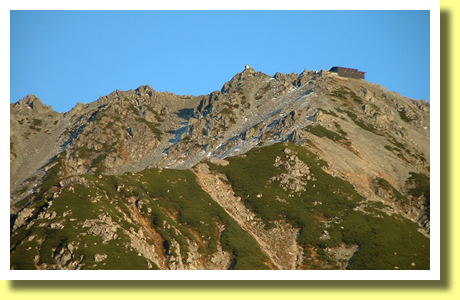
Up there on the top of Oyama ( above ), one of the peaks of Tateyama Mountain Range, is a shrine, Oyama Jinja. People have climbed and climb up to the shrine ( altitude 3,003 meters ) to worship for hundreds years.
During Tokugawa Period, the buildings of the shrine had been repaired by the feudal lords of the Maeda family who had ruled the largest feudal domain, whose capital city is Kanazawa, Ishikawa Prefecture.
|
|
Murodo
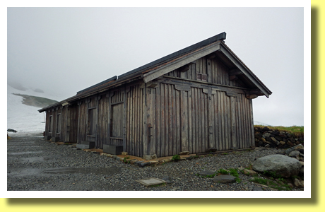
There in Murodo-daira had been accommodation facilities such as Murodo ( above ) which was built in A.D.1726 for people who climbed up to Oyama Jinja shrine to worship.
Murodo is one of the designated National Important Properties of Japan. "Murodo-daira" is named after "Murodo". "Muro" in Japanese means "rooms" or "accommodation", "do" does "religious building" and "daira" does "plateau".
|
|
Sekibutsu ( Stone Buddha )
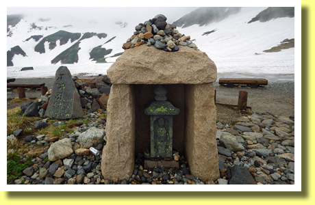
There are dozens of stone images of the Buddha around Murodo and along the way connecting the foot of Tateyama mountains and Murodo-daira. Such images were built a few hundreds years ago. The image shown in the above photo was built in A.D.1811.
|
|
Midagahara ( marshland )
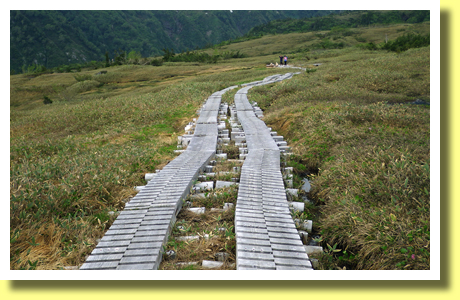
There along Tateyama Kurobe Alpine Route are some more sites popular among tourists such as Midagahara ( above ), which is one of Ramsar Sites as an valuable marshland.
There are walking paths networking Achi-Kochi ( here and there ) around Midagahara. While walking around, tourists could see various alpine flowers in summer as well as coloured leaves in autumn.
|
Copyright (c) 2021 Achi-Kochi Zanmai Co., Ltd.
|